DGPS Points Creation
Enhancing Geospatial Accuracy for Precision Surveying
At Vasista Engineering Solutions, we specialize in Differential Global Positioning System (DGPS) Points Creation, ensuring high-accuracy geospatial data for surveying, mapping, and infrastructure development. Our expertise in real-time kinematic (RTK) and post-processing DGPS techniques guarantees precise location mapping across diverse industries.
What is DGPS?
Differential GPS (DGPS) enhances standard Global Positioning System (GPS) accuracy by correcting errors using ground-based reference stations. This results in sub-meter to centimeter-level precision, making it ideal for high-accuracy surveying and geospatial applications.
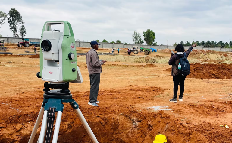
Our DGPS Services
🔹 DGPS Control Point Establishment
- Setting up high-precision control points for geospatial mapping
- Establishing benchmark references for large-scale infrastructure projects
- Permanent and temporary ground markers for engineering surveys
🔹 RTK & Static DGPS Surveying
- Real-Time Kinematic (RTK) surveys for on-the-spot accuracy
- Static and post-processed DGPS surveys for extended geospatial mapping
- Geodetic network establishment for GIS and cadastral mapping
🔹 Topographic & Land Surveying
- High-resolution terrain mapping and contour generation
- Boundary demarcation and property mapping
- Elevation modeling and land development planning
🔹 Infrastructure & Utility Mapping
- Precise positioning for roadways, railways, bridges, and utilities
- Pipeline route alignment surveys for oil, gas, and water distribution.
- Digital mapping for smart city planning and land administration.
🔹 DGPS-Based GIS & Remote Sensing Integration
- Geospatial database creation for urban and rural planning
- High accuracy georeferencing for satellite and aerial imagery
- Integration with LiDAR, UAV, and photogrammetry data
Key Advantages of DGPS Points Creation
- Centimeter-Level Accuracy – Superior to conventional GPS methods
- Error Correction & High Precision – Reduces signal interference & multipath errors.
- Real-Time & Post-Processed Data Collection – Flexibility for different project needs
- Reliable Geospatial Data for Infrastructure & Planning
- Seamless Integration with GIS & Digital Mapping Systems
Industries We Serve
- Civil Engineering & Construction – Site layout, foundation planning, highway surveys
- Oil & Gas Pipelines – Route planning, right-of-way mapping, asset management.
- Land & Cadastral Surveys – Legal property mapping, urban & rural development.
- Agriculture & Forestry – Precision farming, watershed mapping, ecosystem studies
- Mining & Geospatial Exploration – Resource mapping, volumetric analysis, stockpile surveys
Why Choose Vasista Engineering?
- State-of-the-Art DGPS Equipment – Industry-leading technology for maximum precision
- Experienced Geospatial Experts – Skilled professionals in GNSS surveying & mapping
- Customized Solutions – Tailored services for specific industry requirements
- End-to-End Project Support – From data collection to analysis & reporting
Achieve Unmatched Geospatial Accuracy with DGPS
Let Vasista Engineering Solutions help you with high-precision DGPS-based surveying and mapping.
